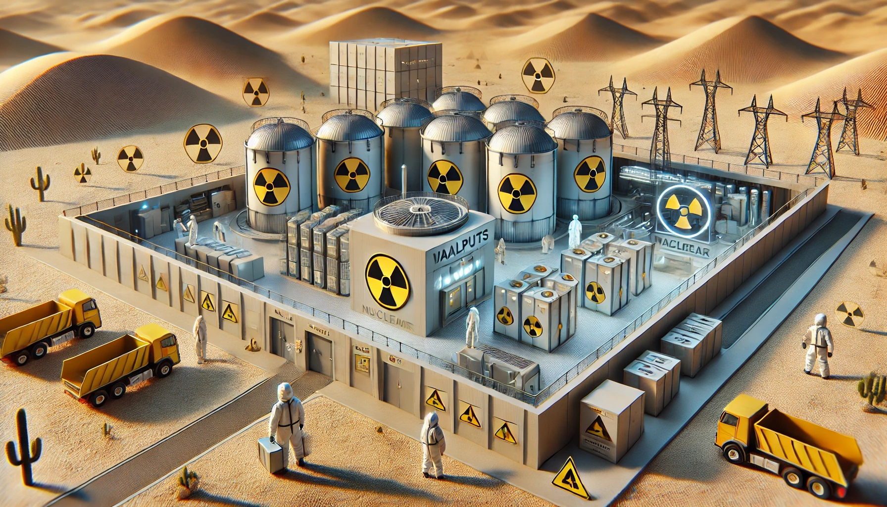
A programme to select a suitable site for the disposal of nuclear waste, entailing the examination of a variety of socio-economic and geology related parameters over large parts of South Africa, commenced in 1978.Initial investigations indicated that the northwest Cape was the most likely candidate area. Further detailed studies showed that a locality some 100 km southeast of Springbok (600 km north of Cape Town) was ideally suited for the disposal of low- and intermediate-level wastes. The initial stage of investigations culminated in 1983 when three farms which now constitute the Vaalputs Radioactive Waste Disposal Facility were acquired by the State on behalf of the NECSA , which will be responsible for its management. The first low- and intermediate-level waste was scheduled for delivery in October 1986.
General
Vaalputs covers an area of about 10 000 ha, measuring 16,5 km from east to west and 6,5 km from north to south at its narrowest point. Approximately 500 – 1 000 ha will be occupied by the sites being developed for low- and intermediate-level waste, an interim spent fuel storage facility, housing, roads, power lines and the airstrip.Vaalputs straddles the escarpment between Namaqualand in the west and Bushmanland in the east and has a mean elevation above sea level of about 1 000 m. Namaqualand is characterised by a rugged granitic terrain with a well-developed drainage system towards the west. Bushmanland on the other hand, is extremely flat-lying, often with ill-defined drainage systems and characterised by gently undulating consolidated sand dunes.
Broadly speaking, Namaqualand falls within the winter rainfall area which has a characteristic succulent type of vegetation, while Bushmanland falls within the summer rainfall area, with its own distinct flora of woody shrubs and grass. Vaalputs therefore falls within the transition zone between winter and summer rainfall and exhibits characteristics of both regimes.
The climate is harsh and in summer temperatures often exceed 40 øC, while in winter freezing conditions and winds with a high chill factor are often experienced. Rainfall is bimodal, with an annual average of about 74 mm, mainly in the form of thunderstorms. Mist is prevalent in the winter months. Years may go by without good rains falling.
Sheep farming is the only agricultural activity of any significance in the area. The carrying capacity is extremely low and one sheep per 9 ha is the generally accepted norm. The population density within a radius of 50 km around the site is extremely low and is most certainly less than one person per square kilometre.
Receiving and inspecting drums with waste at Vaalputs
Plastic hangers are often found in our closets, but we rarely think about their effect on the planet. Many people ask if they can be…
One Comment
Hello, Neat post. There’s an issue together with your site in internet explorer, would check this텶E still is the marketplace chief and a large element of other folks will leave out your magnificent writing due to this problem.
We use cookies on our website to give you the most relevant experience by remembering your preferences and repeat visits. By clicking “Accept”, you consent to the use of ALL the cookies.
This website uses cookies to improve your experience while you navigate through the website. Out of these cookies, the cookies that are categorized as necessary are stored on your browser as they are essential for the working of basic functionalities of the website. We also use third-party cookies that help us analyze and understand how you use this website. These cookies will be stored in your browser only with your consent. You also have the option to opt-out of these cookies. But opting out of some of these cookies may have an effect on your browsing experience.
Necessary cookies are absolutely essential for the website to function properly. This category only includes cookies that ensures basic functionalities and security features of the website. These cookies do not store any personal information.
Any cookies that may not be particularly necessary for the website to function and is used specifically to collect user personal data via analytics, ads, other embedded contents are termed as non-necessary cookies. It is mandatory to procure user consent prior to running these cookies on your website.
We use cookies to ensure that we give you the best experience on our website. If you continue to use this site we will assume that you are happy with it.


Hello, Neat post. There’s an issue together with your site in internet explorer, would check this텶E still is the marketplace chief and a large element of other folks will leave out your magnificent writing due to this problem.